Ripple Park
, 2008 bis 2011, Visbek
nominated for the german landscape architecture prize of 2017
nominated for best private plots 2012
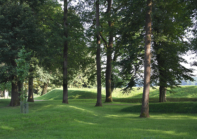
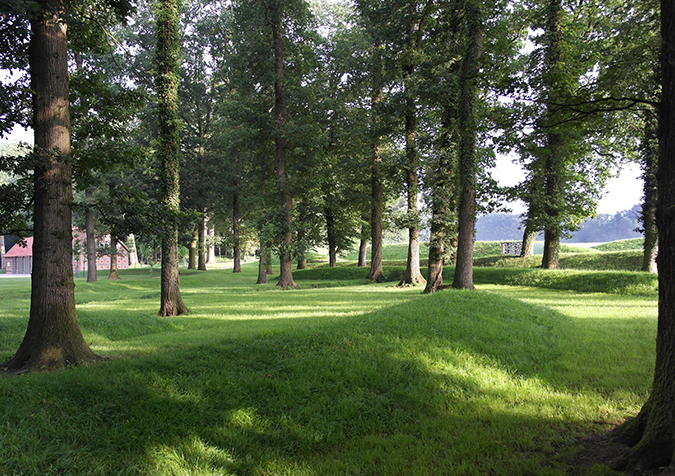
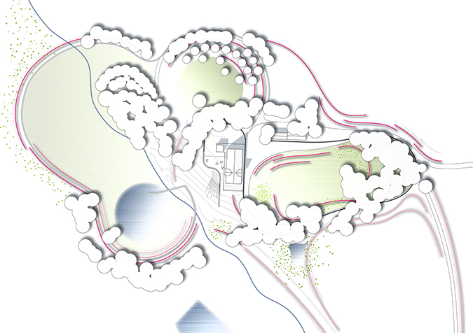
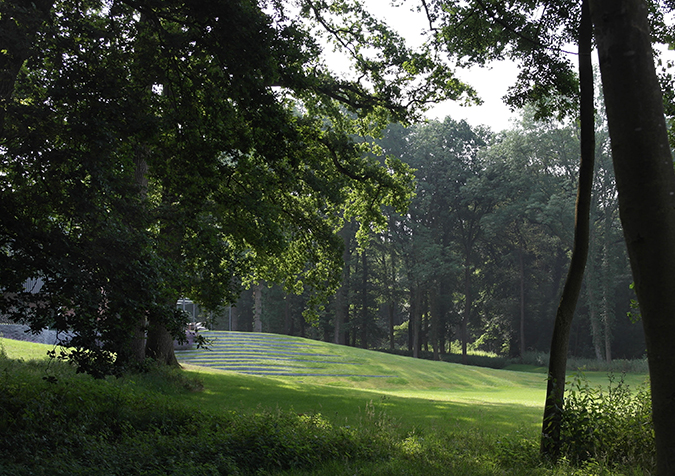
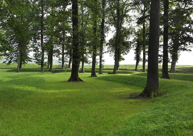
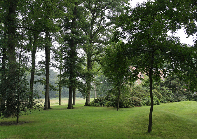
The Oldenburger Münsterland is characterized as an agricultural region in Lower Saxony, Northern Germany. The aim of the project was to realign the boundaries of the existing estate and embed the historic farmhouse in a generous pleasure ground. At first view a dense, two hectare wide afforestation of common spruce from the seventies dominated the whole site in the east of the estate. On closer examination we could recognize an accumulation of beautiful ingrown mature oak trees. The forest clearance of the spruce trees and the dissection of the historic oaks were the first steps of the transformation of the site. Beside the upgrade of the valuable ancient oak tree population a second, newly discovered element was a visual reference for the further conceptual proceeding: in the neighboring area of the pleasure ground- not deranged from the land clearance in the late sixties- we could find astonishing tipped earth walls as an historic layer from the 18 century. In the Saxony lowland these waist-high linear walls are typical to mark the boundaries and separate the wide agricultural areas. The continuation and the creative reinterpretation of the motif âgreen boundary linesâ have been developed to a major concept of design for the topographic layer. With this minimalist instrument of design we could solve the demand of the contour to the farmland in a fluent way without an hard cut between inside and outside. The spacial concentration of the central grass bowl was realized with floating green rings rising in height from the center towards outside. The earth walls with their graduated height have been managed between the oak populations because of their vulnerable root system. For this enterprise we generated with the help of digital tools (fluid simulation models) the possible position of the linear walls. This âfluid-moduleâ is a tool kit of 3d Software Maya. Based on the data from the geometer with the exact localization of the oaks we could simulate the design concept digital and transfer it during the construction period. The âripple parkâ gains his reduced formal shape with the help of two strong instruments for landscape architects: powerful old trees and the rediscovery of topography in current landscape architecture.
The Oldenburger Münsterland is characterized as an agricultural region in Lower Saxony, Northern Germany. The aim of the project was to realign the boundaries of the existing estate and embed the historic farmhouse in a generous pleasure ground. At first view a dense, two hectare wide afforestation of common spruce from the seventies dominated the whole site in the east of the estate. On closer examination we could recognize an accumulation of beautiful ingrown mature oak trees. The forest clearance of the spruce trees and the dissection of the historic oaks were the first steps of the transformation of the site. Beside the upgrade of the valuable ancient oak tree population a second, newly discovered element was a visual reference for the further conceptual proceeding: in the neighboring area of the pleasure ground- not deranged from the land clearance in the late sixties- we could find astonishing tipped earth walls as an historic layer from the 18 century. In the Saxony lowland these waist-high linear walls are typical to mark the boundaries and separate the wide agricultural areas. The continuation and the creative reinterpretation of the motif âgreen boundary linesâ have been developed to a major concept of design for the topographic layer. With this minimalist instrument of design we could solve the demand of the contour to the farmland in a fluent way without an hard cut between inside and outside. The spacial concentration of the central grass bowl was realized with floating green rings rising in height from the center towards outside. The earth walls with their graduated height have been managed between the oak populations because of their vulnerable root system. For this enterprise we generated with the help of digital tools (fluid simulation models) the possible position of the linear walls. This âfluid-moduleâ is a tool kit of 3d Software Maya. Based on the data from the geometer with the exact localization of the oaks we could simulate the design concept digital and transfer it during the construction period. The âripple parkâ gains his reduced formal shape with the help of two strong instruments for landscape architects: powerful old trees and the rediscovery of topography in current landscape architecture.